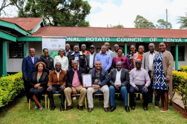
As the second most important food crop after maize in Kenya, the potato industry is a cornerstone of national food security and livelihoods, employing an estimated 2.5 million people across the value chain.[1] Yet maximising yields is a delicate balancing act. From the constant threat of late blight — which KALRO and CIP experts estimate causes average annual production losses of 23–70% in Kenya depending on variety and conditions — to rising input costs, farming demands precise, timely decisions. Historically, crop scouting meant walking the fields, discovering infestations only after damage had already spread. Today, a new era of data-driven agriculture is taking flight. Fahari Aviation, established in 2020 as a Kenya Airways subsidiary and a KCAA-accredited UAS training centre and licensed commercial operator,[3] has partnered with NPCK to redefine what is possible for Kenya’s potato value chain.
SECTION 01
Eyes in the Sky: Precision Mapping and Early Disease Detection
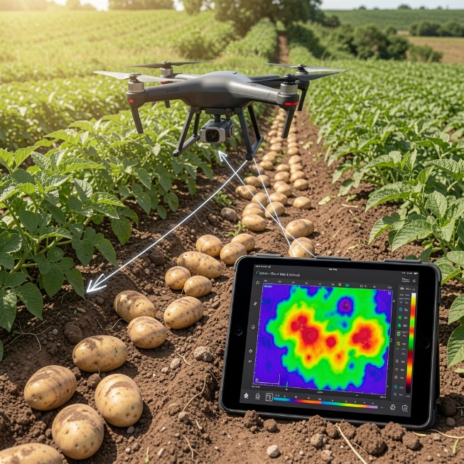
The true value of a drone does not lie in its ability to fly, but in its capacity to see what the human eye cannot. Equipped with multispectral sensors — cameras capturing specialised light data across the near-infrared spectrum — agricultural drones generate NDVI maps (Normalised Difference Vegetation Index): colour-coded field portraits showing zone by zone where crops are healthy, stressed, or infected.[4]
For potato production, this unlocks two critical advantages. First, early and late blight detection: according to research by Mohr et al. (2020), published in the peer-reviewed journal Remote Sensing, near-infrared spectral signatures in potato foliage shift detectably up to 7–10 days before late blight lesions become visible at canopy level — a finding further supported by Zhou et al. (2023) in Applied Spectroscopy, whose study achieved pre-symptomatic detection nine days before visual symptoms appeared, with greater than 96% accuracy.[5] This means that before a farmer on the ground can see any sign of disease, multispectral drone mapping has already flagged the stress response — the precise window when intervention is still low-cost and highly effective. Second, optimised crop scouting: a 50-acre holding that takes an agronomist two to three days to cover on foot is fully mapped in under two hours, allowing ground-truthing to be targeted exactly where it matters most.[6]
| A 50-acre holding surveyed in under 3 hours — blight alerts 7–10 days before visible symptoms. Evidence first. Spray only where needed. |
SECTION 02
Targeted Application: Precision Spraying and Zero Soil Compaction
From Reactive to Predictive. Beyond diagnostics, spray drones equipped with ultra-low volume (ULV) atomised misting technology deliver crop protection products exactly where GPS-guided prescription maps direct — eliminating the overlap, drift, and blanket dosing of conventional programmes.[7] Industry-benchmarked efficiency gains:
| KEY BENCHMARKS | Industry-Benchmarked Performance — Drone vs. Conventional Application |
| Up to 30% | Reduction in agrochemical volume per hectare through targeted, variable-rate application. [8] |
| Up to 90% | Reduction in water usage versus conventional knapsack or boom-sprayer programmes. [9] |
| ~15–20× | Faster coverage rate than manual application — enabling timely response to disease hotspots. [10] |
| 0 | Soil compaction impact. Drones fly above the canopy — zero wheel tracks across potato beds, protecting tuber development and soil structure. [11] |
The zero-compaction figure matters most for potato. Research by Stalham et al. found that compacted fields had on average 40% lower total tuber yield, with marketable yield reductions of up to 50% in severely affected fields.[11] For certified seed growers with contractual quality specifications, this is a core agronomic decision with direct market consequences. Drone spraying also removes operators from agrochemical exposure entirely.
| Zero soil compaction. Up to 30% less chemical. Up to 90% less water. The difference between a good season and a great one. |
SECTION 03
Building the Ecosystem: A Call to Action
Isolated technology cannot solve systemic challenges. True transformation requires an integrated ecosystem where data, agronomy, and market logistics connect seamlessly. Fahari Aviation and NPCK are building exactly that — scouting and spray packages aligned to Kenya’s potato calendar, agronomist and pilot training, and county-level demonstration deployments, accessible from 10 acres to 1,000. In October 2026, NPCK itself hosts the 13th World Potato Congress at Naivasha — the first time in this global event’s history it comes to Sub-Saharan Africa.[12] Kenya’s potato community should not simply welcome that audience. It should have the evidence, in hand, to show the world what is possible.
Investing in drone technology is no longer just about adopting the latest innovation — it is about building a predictable, sustainable, and profitable potato value chain for Kenya. A scouting flight costs a fraction of one unnecessary fungicide application. Contact Fahari Aviation to begin.
| Engage With Us
Fahari Aviation is a subsidiary of Kenya Airways, dedicated to pioneering precision UAS solutions across Africa. NPCK member farmers and agronomists interested in drone scouting or spray services are encouraged to contact the NPCK Secretariat or reach Fahari Aviation at operations@fahariaviation.com. Fahari Aviation (K) Ltd | A Kenya Airways Subsidiary | KCAA-Accredited UAS Operator & Training Centre In partnership with the National Potato Council of Kenya (NPCK) |